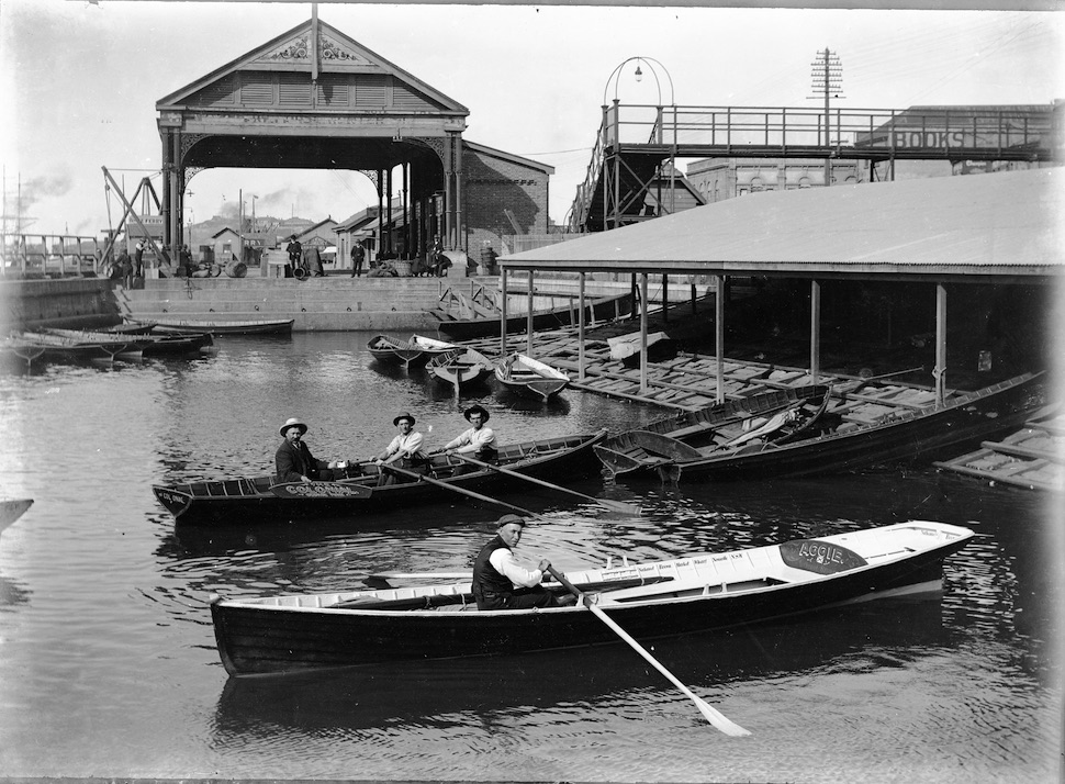
© 2018 Greg & Sylvia RAY

Panorama of Newcastle, circa 1902.

This delightful panoramic view of Newcastle Harbour, taken from Cathedral Hill, was created between 1899 and 1907 by Charleston Studios, a prominent photographic presence in the city at the time. It has been scanned from a folding copy in an old pamphlet and the digital copy has been carefully restored by Sylvia Ray. In the front right is a portion of the since-dismantled Cathedral graveyard. Stockton shows large in the background, with the masts of the sunken ship Regent Murray (lost in 1899) poking above the waterline at the end of the Oyster Bank. The old…

Continue ReadingPanorama of Newcastle, circa 1902.

Newcastle’s lost map-of-the-world pool

So many myths surround Newcastle’s lost and lamented Young Mariners’ Pool, with its legendary concrete map of the world. Many people believe the lost continents still lie beneath the sand, and that determined digging will reveal them in their former glory. Alas, the fact is that only some fragments of the map sections around the edge of the pool remain to be exposed from time to time. Most of the concrete map was broken up by Newcastle City Council in the 1960s and the pieces were dumped off Nobbys breakwater to supplement the always-eroding wave barrier.…

Continue ReadingNewcastle’s lost map-of-the-world pool

Christ Church Cathedral’s migrating gravestones

Quick facts about Christ Church graveyard Newcastle's first formal burial ground Sporadic burials from as early as 1802 Officially proclaimed by Commandant Wallis in 1817 Estimated number of burials: 3300 38 per cent of the total burials were infants under three years of age Burials ceased in the early 1880s but some "illegal" burials took place after the official closure in 1884 From at least 1958 Newcastle City Council lobbied to take control of the site for conversion to a park as part of a trade-off to facilitate the construction of the King Street parking station…

Continue ReadingChrist Church Cathedral’s migrating gravestones
×
×

Cart